ADVERTISEMENT
Haiti
Fonds-Verrettes, Haiti
Fonds-Verrettes also known as Fond Verrettes is a Haitian municipality located in the Ouest Department in Haiti. The municipality lies in the border between Haiti and the Dominican Republic. Fonds-Verrettes currently inhabits 40,224 people. The geographical location is identified by latitude of 18.3914 degrees, longitude -71.8569 degrees and at altitude of 824 meters above sea level. The time zone of Fonds-Verrettes is America/Port-au-Prince. Another commonly used name for this location is La Mission.
LeCayes Exports bananas, sugar, dyewood, coffee, timber and cotton
Among the list of exports that ship out regularly from Les Cayes, one of Haiti's biggest ports in the South, are hides, bananas, sugar, dyewood, coffee, timber and cotton. The increase in the city's importance to international trade led to the once poorly established road structure being formally paved and linked to Port-au-Prince for easy access.
Frere Joel in Cormier Plage
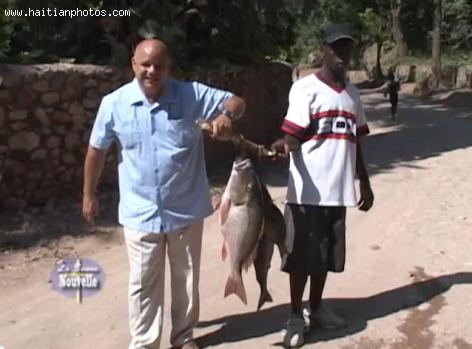
Picture of Frere Joel with Fish caught in Cormier Plage
The love for Cormier Plage is great. Patrons often visit for the use of the restaurant and bar alone. It's great for day visits and meetings with friends, weddings and conferences. The hotel's blend, the Cormier Punch, is a hit with those who frequent there. There are regular artisan sales with jewelry, bags, shoes etc. for purchase at a great price. The staff has been described as amazingly helpful and friendly, the food excellently delicious and the visit to the Cormier Plage, a dream.
Cormier Beach, exclusive beach-front views
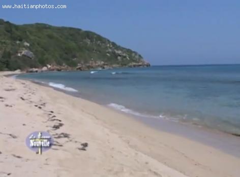
It is often described as one of the most endearingly beautiful resorts Haiti has to offer, and the Cormier Plage never disappoints where its one of a kind beach is concerned. For its beauty and exclusive beach-front views, the resort often gets selected on the lists enumerating the loveliest hotels in Haiti. Its rooms are spacious and airy, and the resort is almost surrounded by the palm trees and lush botanical gardens that help make it so beautiful.
Belly Beach, the adobe for natural charm and flawless beauty
Belly Beach, also sometimes known as the Coco Beach is the adobe for natural charm and flawless beauty. Fortified with coconut trees on all sides, it looks as if Mother Nature has cut herself off from the rest of the world just to offer its visitors with a surreal dream paradise. Seemingly impregnable, the Belly Beach is accessible only by boats, horseback or cars. With its white glittering sand and shinning blue waters, the beach is just perfect for those who want to escape the grey world of machines for a few intimate moments of wild imagination.
Canaan, Jerusalem, Camp Corail-Casselesse and ONAville
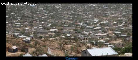
Here is a picture of Camp Canaan. A lack of proper planning seems to be the culprit behind the rapid and complete deterioration of Camp Corail. Promised to have been an almost completely self-sustaining community for those displaced after the 2010 earthquake, the community was to have presented 30, 000 jobs and provide schools, health care and amenities like electricity, food and water. While it met some of its targets, the factories, like one promised from an apparel company from South Korea, were not open for business when the masses moved in. Soon, thousands more than planned for flocked to the promise of new jobs, erecting tents and shacks to house themselves.
Enjoying a good time at Saut-Mathurine in Camp-Perrin
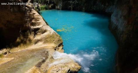
The wonderful Saut Mathurine Falls is free to see and the experience would be worthwhile at any price for the spectacular beauty of the destination. In preparation for the journey, one should note that the months for rain include May, August, September and October, with November through to March being the driest months. The temperature there, on average, lies between 23oC and 26.6oC. Pack a good, comfortable pair of shoes for walking, a camera, clothes for swimming, drinking water and bug spray. It's also wise to pack an umbrella for the journey, especially during the four rainiest months of the year.
Camp-Perrin and Tourism
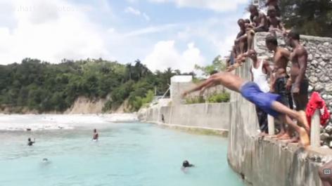
Picture of children in the water in Camp-Perrin.
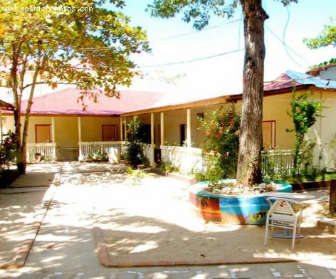
When visiting Camp-Perrin, take the opportunity to visit the Mercen ruins, the waterfall of Saut Mathurine and sight see everything from rare birds, the lush, verdant landscape, glorious flora and fauna and even the homes of the wealthy and religious seminaries. While sightseeing, listen to any one of Camp-Perrin's five radio stations on the FM band. For stay-overs, you may sleep at the Recul Hotel, which is well equipped to handle conferences and parties of varying sizes.
Camp-Perrin map
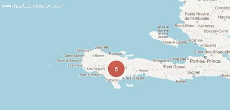
In the municipality of Les Cayes Arrondissement, in Haiti's Sud Department, lies Camp-Perrin or Kanperen in Creole. Home to over forty thousand residents on its last census from ten years ago, Camp-Perrin has come a far way from the original three inhabitants it boasted three hundred years ago. On its administrative side, the town is split into three counties, the First Section, Lévy-Mersan, the Second Section, Champlois-Marceline and the Third Section, Tibi-Davezac.
La Navase, small Haitian Island but also claimed by the United States
La navase also spelled La Navaze is a Haitian Island locate about 25 miles southwest of the city of Jeremie and 37 miles from Haiti's western-most peninsula. It is a 1,300-acre land with no fresh water. La Navase is uninhabited but Haitians have fished its coasts regularly
In 1856, The United States Congress passed the Guano Islands Act, given authority to any US citizen to seize any uninhabited island. One year later, in 1857, Captain Peter Duncan and Edward Cooper invaded La Navase,
The island of La Navase is reach in guano, a mixture of nitrate and phosphate that could used as fertilizer and powder in armament.
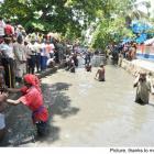 PM Evans Paul at Bassin St Jacques Majeur, Plaine du Nord
  Jounalis Phares Duverne mouri
  Children of Haitian descent handcuffed, deported from the Bahamas
 _____________________
 Jovenel Moise, the president has spoken. Period
 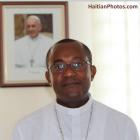 Pope Francis appointed Mgr. Launay Saturne Archbishop of...
  Meet Haitian-American professional baseball pitcher Touki...
 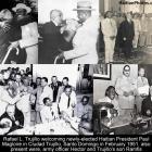 Rafael L. Trujillo welcoming Paul Magloire in Santo Domingo
  Dr. Michaëlle Amédée Gédéon is dead