ADVERTISEMENT
fort liberte
U.S. Marines in Fort Liberte in 1916
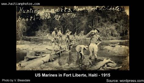
Here is a picture of United States Marines during the occupation of Haiti in 1916. This picture was taken during a hunting operation of Caco.
The United States occupation of Haiti started July 28, 1915 during the government of U.S. President Woodrow Wilson and ended on August 1, 1934 during the government of Franklin D. Roosevelt
Bishop of Fort-Liberté, Mgrs Quesner Alphonse
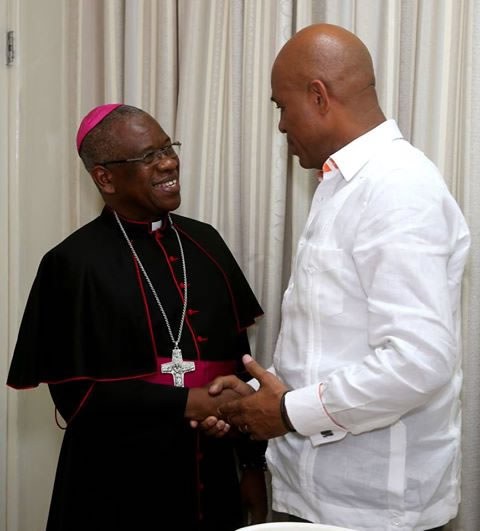
Here is a picture of the new Bishop of Fort-Liberté, Mgrs Quesner Alphonse who is meeting President Michel Martelly at the National Palace
On Saturday, 25 October, 2014 Pope Francis appointed Monseigneur Alphonse Quesnel, the SMM of the Province of Haiti, as the ordinary of the Diocese of Fort-Liberté. Fort-Liberté is a commune and the administrative capital of the North-East Department, Haiti, under the French rule it was known as Fort-Royal and Fort Dauphin, it is very near to the border of the Dominican Republic with a population of about 371,000 Roman Catholics and served by a presbytery of 48 priests and 68 religious. Monseigneur Alphonse Quesnel had been serving as the auxiliary bishop of the Archdiocese of Port-au-Prince since December 2012. After completing his probationary period in 1972, he started his profession as Montfort missionary. In July 16, 1977, he was ordained a priest on the Feast of Our Lady Mount Carmel. Bishop Quesnel is known throughout the congregation for his contribution in the work of formation and as a parish priest.
What is left of Dauphin Plantation in Fort Liberte, Haiti
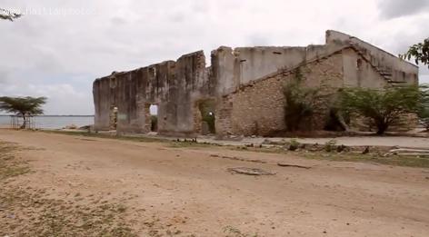
Here is a picture of a building in Fort Liberte that was served to house Sisal from the Dauphin Plantation in Fort Liberte, Haiti.
At the Time, there was a good demand for sisal worldwide and it was very profitable to get into this business.
The plantation of sisal covered what is to be known now as Bay Plantation. The area covered Lake Romeo all the way to the mountains and then northwest to the ocean with the western boundary along the river that flows by Terrier Rouge.
As sudden decrease in the prise of sesal in the world market forced the project to close
By the beginning of World War II, Haiti had a huge plantation of sisal which was estimated at around 13,500 acres
The History of plantation Dauphin in Fort Liberte
In February 1926, Andre De Coppet, a wealthy Wall Street financier decided to produce sisal in Haiti.This is a fiber useful for products like rope and binder twine and Haiti soil and climate was ideal for it, he decided to grow it in the area around the city of Fort Liberty.
During the 1950's, the world market price for sisal fiber declined to reach an all time low in 1970. Plantation Dauphin was losing money. Finally, it was closed
Fort Liberte Map
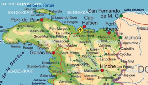
The city of Fort Liberte is situated in Nord-Est, Haiti, its geographical coordinates are 19° 40' 4" North, 71° 50' 23" West. It is the administrative capital of the Nord-Est Department, Haiti.
Fort Liberte is located near the border of the Dominican Republic. The city is one of the oldests in Haiti.
The arrondissement of Fort Liberte has three municipalities: Fort-Liberté, Ferrier and Perches.
During the colonization period, Fort Liberte was a major plantation area of coffee
Staghorn corals found near Fort Liberte
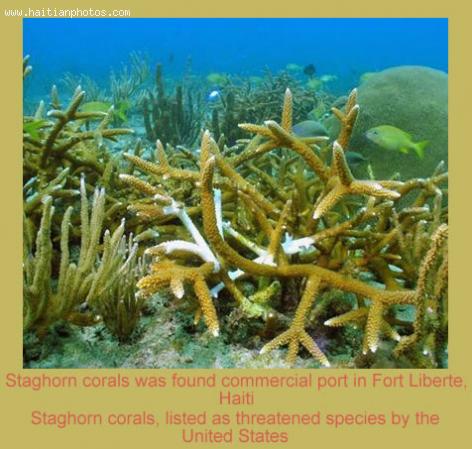
Off the eastern edge of the opening to Fort Liberte Bay is a beautiful wall equiped with somethin special. Staghorn corals are found near Fort Liberte.
With its disappearing tropical forests and ravaged wetlands, it has been a surprise discovery recently about the Caribbean island. The discovery of endangered corals and a rare tiny lizard along its northern coast is threatening an ambitious vision to spur economic growth.
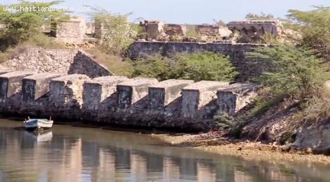
The City of Fort-Liberte
The bay of Fort-Liberte at one point was the site of Caribbean's largest sisal plantation until nylon was invented.
An economy that use to depend strictly in agriculture, Fort-Liberte had in the old days had a vibrant economy. The region was reputable for its tillage plantation, but also sugar-cane, coffee, cocoa, and cotton. At one point during the Colonization period, there were 793 sugar plantations, 3,117 coffee plantations, 789 cotton plantations,
View of Fort-Liberte
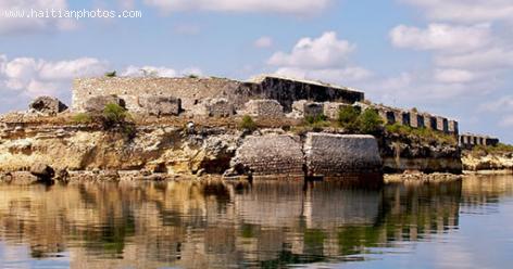
A city naturally designed to be a great place. The coast line between Fort-Liberté Bay and Point Yaquezi has a low sandy beach. The reefs with mangrove forests are unique. The entrance to the city is easily recognizable
Between 1503 and 1505, Nicolás Ovando founded the town of Puerto Real around the town of Caracol, to the west of Fort-Liberté.
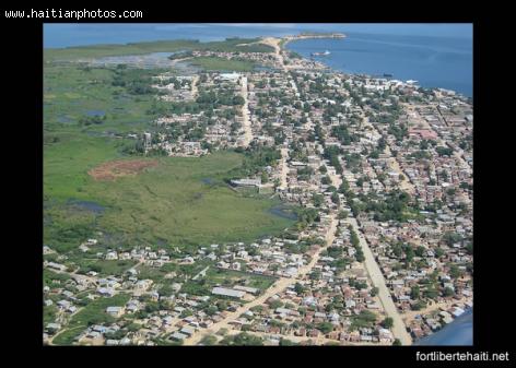
View of Fort-Liberte, Haiti
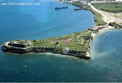
Here is an areal view of Fort-Liberte, Haiti. During the time of the Colonialization, The Harbor of Fort-Liberte was a major port for import and export.
The port is strategically located in the centre of the bay and used to be utilized as a naval base by the French
There ater two major forts which are at the base of the city name. Fort Lachatre and Fort Labourque were captured by Toussaint Louverture the leader of the Haitian Revolution, in 1793.
Cathedral of Fort-Liberte
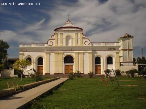
This is a colonial Cathedral in the historic city of Fort-Liberte.
Fort-Liberté is located in the Nord-Est Department, which borders the Dominican Republic.
It is part of three municipalities, including Ferrier and Perches. The City of Fort-Liberte has a long history. During the colonial era, it was a major plantation area, and today it remains an important coffee-producing area.
 Gas Station In Haiti
  Five personalities of the Haitian musical world awarded
  Haitian Flag Under Francois Duvalier changed in 1964 to black...
 _____________________
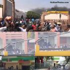 Delimart Plaza, Delmas 32, Port-au-Prince, Haiti being looted
 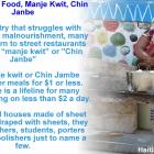 Haiti Street Food, manje kwit or Chin Janbe, for $1 or less
 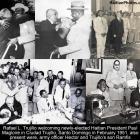 Rafael L. Trujillo welcoming Paul Magloire in Santo Domingo
 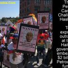 The Petro Caribe Challenge hashtag
 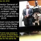 Former PNH Chief, Godson Orelus, arrested for illegal arm...