ADVERTISEMENT
Photos
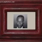
Depite Aquin - Emmanuel Fritz Gerald Bourjolly - 2013
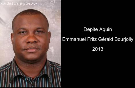
Here is a picture of the Deputy of the small town of Aquin, Depite Emmanuel Fritz Gérald Bourjolly in 2013. The deputy of Aquin has been through a lot of problem recently. His latest had to do with a Rape Case. Depite Emmanuel Fritz Gérald Bourjolly was recently accused for participating in rape. This is something that was never confirmed however.
BOURJOLLY, Emmanuel Fritz Gerald
Lieu de naissance : Aquin
Date de naissance : 17 Janvier 1965
Profession: Avocat, comptable, enseignant
Circonscription: Aquin
- Parti politique: INITE
The map of Aquin, in Haiti
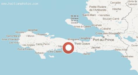
The small Haitian town of Aquin is a municipality in the Aquin Arrondissement. Itis located in the in the Sud Department of Haiti. It is a port on the south coast of the Tiburon Peninsula.
The population of Aquin is estimated at 95,004 inhabitants based on a Census taken in 2003
Aquin borders the Caribbean Sea, and it is found on your way from the Haitian Capital Port-au-Prince in direction to Les Cayes
Place Catherine Flon in Arcahaie
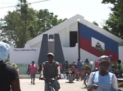
Here is a picture of Place Catherine Flon. This was taken from a documentary conducted by Frere Joel.
Catherine Flon is viewed the symbols of the Haitian Revolution and independence.
She was the one responsible to sew the Haitian flaf, the first Haitian flag on May 18, 1803. According to history, this took place on the last day of the memorable Congress of Arcahaie. History also reported that Catherine Flon was the goddaughter of Jean-Jacques Dessalines.
Katherine Flon and a Painting of the Haitian Flag

Here is a picture of the Haitian flag with the person who has credit for its creation, Katherine Flon Haitian.
The town of Arcahaie became a famous town due to its historical heritage. This was the place that hosted the 1803 Congress for teh independence of Haiti. The exact date for taht congress was May 14 to May 18.
During the congress, Jean-Jacques Dessalines tore up the French flag and replaced it with a blue and red flag. This is how the Haitian Flag was created.
City of Arcahaie Map
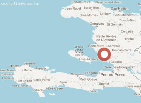
Here is a map of of the historic town of Arcahaie in Haiti. It has a lot of meaning for the independence of Haiti. Every year, during Haiti Flag Day on May 18, there is an important ceremony to commemorate the our flag.
The town of Arcahaie is a municipality in the Arcahaie Arrondissement and according to the last census, its population is estimated at 102,639 inhabitants.
Te town of Arcahaie in Haiti
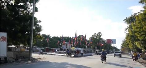
Arcahaie is an agricultural town. It is also an important charcoal producing and trade region
It is located in the Department of Ouest in the arrondissement along the coast of the department
Arcahaie is located about 45 kilometers north of Port au Prince.
The town is estimated to have a population of about 102,639 people and considered as the chief town of the department. Arcahaie has a total area of 404.6 and lies between 9° 49' 0" North, 72° 55' 0" West.
Fort Drouet in Haiti
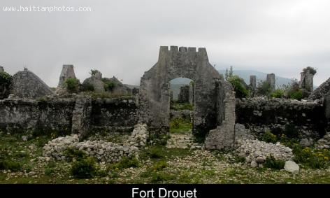
There has been over 40 fortifications that were built after the Independence of Haiti to guard against an eventual return of the French to reestablish slavery in the colony of Saint Domingue
Fort Drouet near the city of Arcahaie is one of them.
Fort Drouet was always part of the inventory of historic sites
Fort Drouet is well visible and has a rather well preserved coffee plantation with its main building,
Fort Drouet can be accessed by road that leads from Mirebalais , passing the cross to Saut d'Eau, to the Route Nationale #1.
Haiti and its deforestation problem
The country of Haiti has a major environmental problem and this problem is dated back a long time.
In 1923 forests covered nearly 60 percent of Haiti. Sadly, today, less than two percent of the country is covered. As the country is moving to a more deserted land, it also has to deal with more and more problems from social to economic and even spiritual. The government of Haiti has not done much to deal with this coming crisis. One of the main problems is that the people continues to cut trees as the main source of fuel.
What is left of Dauphin Plantation in Fort Liberte, Haiti
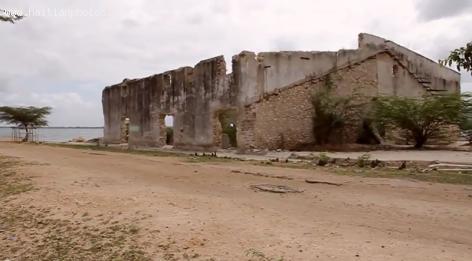
Here is a picture of a building in Fort Liberte that was served to house Sisal from the Dauphin Plantation in Fort Liberte, Haiti.
At the Time, there was a good demand for sisal worldwide and it was very profitable to get into this business.
The plantation of sisal covered what is to be known now as Bay Plantation. The area covered Lake Romeo all the way to the mountains and then northwest to the ocean with the western boundary along the river that flows by Terrier Rouge.
As sudden decrease in the prise of sesal in the world market forced the project to close
By the beginning of World War II, Haiti had a huge plantation of sisal which was estimated at around 13,500 acres
The History of plantation Dauphin in Fort Liberte
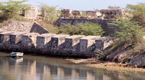
In February 1926, Andre De Coppet, a wealthy Wall Street financier decided to produce sisal in Haiti.This is a fiber useful for products like rope and binder twine and Haiti soil and climate was ideal for it, he decided to grow it in the area around the city of Fort Liberty.
During the 1950's, the world market price for sisal fiber declined to reach an all time low in 1970. Plantation Dauphin was losing money. Finally, it was closed
 Who will be the next president of Haiti?
 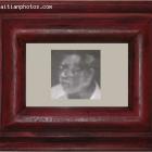 Luc Desir Was A Member Of Francois Duvalier And Jean-Claude...
  François Nicolas Duvalier Potential Candidate for President of...
 _____________________
 Partial list of privileges enjoyed by Government officials in...
  Rafael L. Trujillo welcoming Paul Magloire in Santo Domingo
  The Petro Caribe Challenge hashtag
 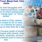 Haiti Street Food, manje kwit or Chin Janbe, for $1 or less
  Jovenel Moise, the president has spoken. Period