ADVERTISEMENT
Photos
Makendal was born in Limbe

Limbé Prepares Slaves to Overcome French
Limbé, French for limb, is an important part of Haiti's struggle for independence.
Limbé's location in a valley, bounded by mountains, protected the slaves living there from discovery as they hiked mountain paths to meet other slaves living below Limbé.
Meeting clandestinely, they built bonds of trust, which enabled them to form a rebel unit to defeat the French.
Limbé was the staging area for the rebel slaves before they engaged French forces in the Vertieres Battle and triumphed in 1803.
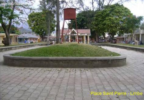
Place Saint Pierre - Limbe
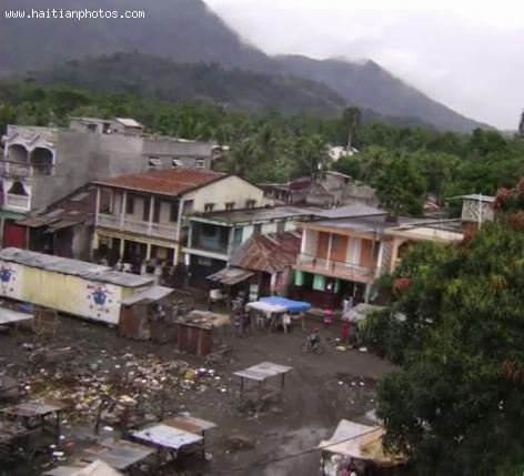
The town of Limbé is an agricultural axis in the Arrondissement du Limbé. The Limbé River, which runs close by, has made the town second in stature behind Cap-Haitien.
Limbé is home to 32,200 occupants and sits north of Port-au-Prince. Its closest neighbors are the towns of Bas-Limbé, Port-Margot, Plaisance, Cap-Haitien, and L'Asul-du-Nord.
Limbé possesses two health-care facilities: Dispensaire St. Jean and Hôpital Bon-Samaritain. Its green cover surpasses most other towns, but soil erosion is still a problem.
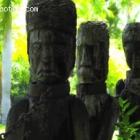
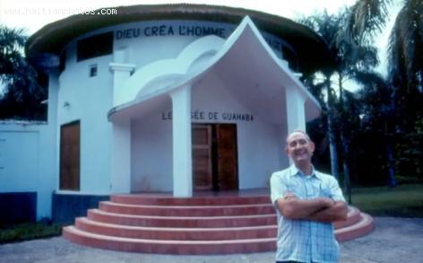
Musee de Guahaba - Limbe
The town of Limbé, part of Arrondissement du Limbé, played an integral part in Haiti's liberation.
Limbé's location in the Valley of Limbé sequestered the town from nearby areas. Its mountains offered protection to slaves engaged in a rebellion to free themselves from bondage.
Limbé slaves traversed mountain paths to secretly meet with slaves living below Limbé. They forged an alliance, which led to their defeat of the French in Cap-Haitien in 1803.
Pre-Colonization Period in the City of Limbe

Limbé Agent in French Defeat
Limbé played a role in Haiti's slave rebellion in the 1800s. Because it lay in the Limbé Valley, surrounded by mountains, slaves had access to other slaves past the Souffrieres River.
Able to travel on mountain paths to slaves living below Limbé, they formed bonds with each other, which prepared them to drive the French out of Cap-Haitien.
Limbé was the staging area for the Vertieres battle, in which slaves defeated the French forces in 1803, a year before Haiti's independence.
Home from Colonial Period in Limbe

In the Arrondissement du Limbé sits the town of Limbé, with 32,200 occupants. Limbé is sub-divided into seven partitions: Tanmas, Haut-Limbé, Souffrieres, Ravine-des-Roches, Simalo, Camp-Coq, and Plaisance.
Important to agricultural viability of Limbé is the Limbé River, which irrigates crops of bananas, mangoes, and other tropical fruits. Coffee farming and rice growing also occur.
Although deforestation has crippled much of Haiti, Limbé has more tree cover than most areas. But the Limbé River is at peril of drying up because of deforestation.
Limbé River Victim of Deforestation

Limbé, a town known for a healthy agricultural industry, is part of a dangerous trend, caused by vanishing tree cover. Large areas of barren ground suffer soil erosion when the rains come; and Limbé River's flow has slowed as a result.
Without Limbé River to help irrigate crops, more crops are failing, affecting the economy of Limbe's 32,200 residents.
Limbé still contains more tree cover than most of Haiti, but how long before more deforestation occurs?
Missing Tree Cover Slows Limbé River's Flow
Limbé, once a thriving agricultural center, has fallen victim to the rampant deforestation in over 96-98% of Haiti. Limbé River, which runs near Limbé, has been an important resource for crop yields of tropical fruits, coffee, and rice.
But lack of tree cover has washed away rich topsoil and reduced Limbé River's flow. The problem is further aggravated by flash floods, which cause the river to overflow its banks and submerge the town during the storm season.
Limbe Map in Haiti
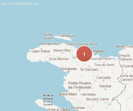
Limbé, a mid-size town of 32,200 residents is part of Limbé Arrondissement, which also includes Bas-Limbé. Seven sub-divisions comprise Limbé: Tanmas, Haut-Limbé, Souffrieres, Ravine-des-Roches, Simalo, and Camp-Coq. Other towns near Limbé are Port-Margot, Plaisance, Cap-Haitien, and L'Acul-du-Nord.
The town contains a rich agricultural climate, supported by the Limbé River. Crop yields produce bananas, mangoes, coffee, and rice. Two hospitals deliver health care services: Dispensaire St. Jean, managed by Catholic sisters, and Hoptial Bon-Samaritain, a project of U.S. Baptist missionaries.
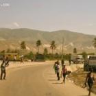
Moto Taxi in Haiti park at will and operate as they see fit

The lack of regulations for moto-taxis has led to the growth of potentially serious problems. Already, moto-taxi drivers have taken over the streets of many cities, parking at will and operating as they see fit. The authorities, who target traffic violators, focus on traditional public transport vehicles, leaving moto-taxis free to take over intersections and sidewalks, often leaving pedestrians no option but to walk in the streets to get around them.
Motorcycle Station in Haiti
Moto Taxi piling on more passengers than are safe
Traffic can be very bad in Haiti. On an average day, you can follow the car before you at a rate of about 2 miles every hour in the nation's capital. One the back of a moto-taxi, driven by a skilled driver, one can speed up that time and cut your commute considerably. The drawback is dealing with the sometimes reckless driving by those drivers who are daredevils. One may also have to share the accommodations, as moto-taxi drivers try to capitalize on their haul with each run, sometimes piling on more passengers than are safe.
 Haiti License Plate or Plaque d'immatricules a DGI
  Five personalities of the Haitian musical world awarded
 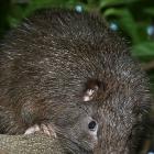 Rodent in Haiti named James Bond's hutia or Plagiodontia...
 _____________________
 Partial list of privileges enjoyed by Government officials in...
 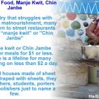 Haiti Street Food, manje kwit or Chin Janbe, for $1 or less
  Jack Guy Lafontant resigns as Haiti Prime Minister
  Former PNH Chief, Godson Orelus, arrested for illegal arm...
  Commissioner Frantz Pierre indicted for accepting bribes